Dirt Roads
September 2013
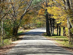
A dirt road meandering through the woods sets songwriters hearts aflutter. John Denver asked Country Roads to take him home. James Taylor went walking on a Country Road. Bob Dylan had the Dirt Road Blues. Country singer Jason Aldean got a Grammy nomination for his Dirt Road Anthem. Lucinda Williams won a Grammy for her Car Wheels on a Gravel Road. Being a predominately rural area, the Lake Champlain Basin has its share of unpaved roads. Collectively they have a distinct impact on our lake.
There are over 14,000 miles of roads in Vermont and 7,000 miles of roads in the five New York counties that are at least partially in the Lake Champlain Basin.
Roads have an ecological impact far greater than would be anticipated based on the amount of area they cover. They act as filters for animal movement; allowing only some individuals to cross. They provide conduits for seed dispersal for many invasive plants. They are direct sources of pollutants like salt, motor oil, and pesticides used to keep vegetation at bay.
Roads alter the way water flows across the landscape, which is their principle impact from the perspective of Lake Champlain. Water falling as rain can not soak into roads so it is shed to ditches and streams, increasing erosion. Additionally, roads intercept groundwater moving downhill altering its flow pattern. This too increases the volume of water in streams.
The relative importance of roads as a source of pollution for Lake Champlain has not received much attention. There have been two models that tried to allocate phosphorus loading among different land uses. Both broke down loads based on three land covers: agricultural land, developed land, and forested land. Loads from forested land were considered background and excess phosphorus was partitioned between agricultural and developed land (loads from sewage treatment plants were subtracted out first). The studies found that although more phosphorus comes from agricultural land than developed land on the whole, that’s because there are more acres of agricultural land. On a per acre basis developed lands produce more pollution. Unfortunately, the data were not sufficiently robust to allow further divisions. The agricultural model didn't differentiate the loads coming from corn fields as opposed to orchards or pastures. In the developed land model a city was viewed as the same as a suburb or a road.
Recently however, University of Vermont researcher Beverley Wemple led a team conducting studies to help understand the relative importance of dirt roads on phosphorus and sediment loading. They worked in the Winooski River catchment collecting water samples along roads during storms, inventorying erosion and deposition, assessing the effectiveness of best management practices, and using mapping software to extrapolate their findings from the small areas sampled to the entire Winooski catchment. Not surprisingly, their results varied considerably from site to site and from storm to storm. Nonetheless, based on their results they estimate dirt roads account for 11-28% of the phosphorus load for the entire catchment with steeper roads generating more phosphorus than flatter roads.
Since pollution loading was closely tied to the slope of the road, targeting best management practices to ditches on the steepest roads can have a greater impact. Examples of appropriate best management practices include vegetated and stone-lined ditches, turnouts, rip rap, and check dams. Wemple found that the presence of such measures was associated with lower frequency and magnitude of erosion on roads.
While Wemple’s studies are the first to try and quantify the effects of dirt roads on water quality in our region, it has long been known that back roads represent a management challenge. Vermont established the Better Backroads Program in 1997 to provide grants and planning assistance for road management. The Lake Champlain Basin Program is currently funding a grant that would provide a model for a similar program in New York.
Back roads are an iconic part of our culture. Their long-term care and maintenance is important for connecting communities, inspiring songsters, and protecting our water quality.
Lake Look is a monthly natural history column produced by the Lake Champlain Committee (LCC). Formed in 1963, LCC is the only bi-state organization solely dedicated to protecting Lake Champlain’s health and accessibility. LCC uses science-based advocacy, education, and collaborative action to protect and restore water quality, safeguard natural habitats, foster stewardship, and ensure recreational access.
Get involved by joining LCC using our website secure form (at www.lakechamplaincommittee.org), or mail your contribution (Lake Champlain Committee, 208 Flynn Avenue - BLDG 3 - STUDIO 3-F, Burlington, VT 05401), or contact us at (802) 658-1414, or lcc@lakechamplaincommittee.org for more information.