What Do River Mouths Have to Say?
June 2025 Lake Look
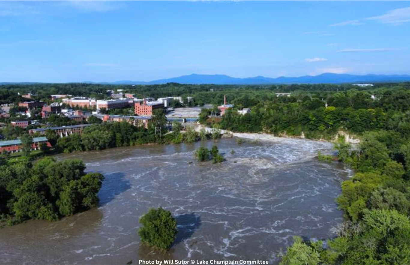
As rain, snowmelt, and groundwater flow from the peaks and ridges of the Adirondacks and the Green Mountains into the Champlain Valley, they follow trickling paths, merge to create headwater streams, and eventually join and broaden into powerful rivers. But at what point does a waterway stop being a river and become part of Lake Champlain? This transition happens gradually in a zone called a river delta where a river empties into the lake.

River deltas are unique wetland complexes. They shift dynamically with changes in water flow and sediment deposition, support biodiversity adapted for both river and lake environments, and play a critical role in mitigating flood impacts on Lake Champlain.
Deltas form as rivers empty their water and sediment into another body of water. As the river slows near the lake, the sediment it carries —called “alluvium”—begins to settle to the bottom. With slow-moving water and alluvium accumulation, rivers form “deltaic lobes”—landforms above the water’s surface comprised of deposited sediments, which will often include a “distributary network,” a series of smaller, shallower channels that branch away from the main river and break up the delta.
Heavier sediment settles first, while finer alluvium—like silt—gets deposited later, often farther into the lake. Silt from rivers in the Lake Champlain Basin is often rich in phosphorus and other nutrients. During floods, rivers can become hazardous, carrying increased levels of contaminants from runoff. Deltas get hit with staggering quantities of sediment and debris. In the July 2023 floods, over 300 metric tons of phosphorus were delivered to Lake Champlain over a seven-day period. Protected wetlands in and around river deltas, particularly when left in their natural state, absorb floodwaters and spread out nutrient-laden sediments. This can help prevent lake levels from rising too quickly and reduce the amount of nutrients entering the lake.
River mouths and their wetlands are important not just for water quality but also for biodiversity. Deltas, lying at the intersection of river, lake, and land ecosystems, create an “ecotone”—a transition zone between two different ecosystems. Terrestrial plants will grow on deltaic lobes, and the frequent disturbance of these landmasses creates ongoing opportunities for new plants to take root. Aquatic plants thrive in the nutrient-rich alluvium—cattails, arrowhead, and pickerelweed are all commonly found in deltas. The roots of these plants help stabilize the soil and absorb nutrients like phosphorus. Fish species such as lake sturgeon will take shelter in warm, verdant river deltas to spawn. Deltas rich in aquatic plant life also support insect, fish, amphibian, turtle, and waterfowl populations as nesting habitats, breeding grounds, and food sources.

Many of the river mouths feeding Lake Champlain are in conservation areas, which allows the river to “breathe” into natural floodplains while enabling the delta to shift with conditions and thrive as an ecotone. The Missisquoi River flows to the lake through the Missisquoi National Wildlife Refuge, an area of almost 7,000 acres managed by the U.S. Department of Fish and Wildlife. Named a Ramsar Wetland of International Importance, the Missisquoi refuge is comprised of a vast mosaic of upland forest, floodplain wetlands, and distributary networks supporting more than 200 species of birds and a fall migration boasting nearly 25,000 ducks. It is a particularly diverse site for aquatic plants like wild rice, a species integral to aquatic habitats above and below the water.
The Ausable River (from the French word for “sandy,” referring to the fine alluvium the river carries) flows into Lake Champlain through the Ausable Marsh Wildlife Management Area, which constitutes over 600 acres of undeveloped wetlands managed by the New York State Department of Environmental Conservation. The Ausable’s distributary networks flow over fertile land that was once used for agriculture and timber harvest and now hosts a range of recreational and scientific uses while providing important waterfowl habitat.
At its convergence with Lake Champlain, the Winooski River flows through the 55-acre Delta Park, managed by the Winooski Valley Park District (WVPD). Small but mighty in terms of habitat diversity, the park is a smattering of marshy wetlands and floodplain forests and includes a half-mile stretch of natural sandy beach along the river, which provides important turtle nesting habitat. The WVPD, with support from the Lake Champlain Basin Program, is in the midst of a multi-year restoration project within Delta Park that focuses on removing dense invasive species populations from the floodplain forest to allow native plants, trees, and shrubs to repopulate. Native plants allow the delta and the surrounding wetlands to function more effectively as habitat and flood barrier.
River mouths have a lot to say, telling stories of transition, adaptation, and foundations for biodiversity. Protecting and restoring wetlands at the confluences of waterbodies is essential for all life that the deltas of Lake Champlain support—including our own.
Lake Look is a monthly natural history column produced by the Lake Champlain Committee (LCC). Formed in 1963, LCC is a bi-state nonprofit that uses science-based advocacy, education, and collaborative action to protect and restore water quality, safeguard natural habitats, foster stewardship, and ensure recreational access. You can join, renew your membership, make a special donation, or volunteer to further our work.