Lake Champlain reached record levels in the spring of 2011 from storm events and snowmelt. These floods devastated communities. State and local communities are acting now to be better prepared for future floods. An important key to better preparation is anticipating the extent of flooding at different lake levels. Communities can limit development in these areas and have plans in place for handling floods in areas that are already developed. In response to the floods, the USGS (for the US) and Environment Canada (for Canada), with funding from the International Joint Commission, developed flood inundation maps. The maps are intended to help residents, emergency responders, and communities react effectively during a flood event. The maps represent potential flooding along the shore of Lake Champlain and in major tributaries in four counties in Vermont (Addison, Chittenden, Franklin, Grand Isle) and one in New York (Clinton). Learn more here.
Flood Inundation Maps Now Available
Posted Tuesday, December 20, 2016
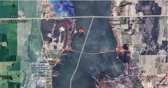
Map courtesy of International Joint Commission.