Mapping Our Natural Resources
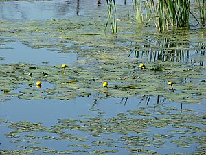
Photo by Jay Kiley.
The Lake Champlain Committee has been working with the Vermont Agency of Natural Resources to help map aquatic natural resources in Vermont. The work is part of a larger project to produce a statewide map and supporting database identifying the lands and waters that support high priority ecosystems, natural communities, and habitats worthy of conservation or restoration.
A committee has been meeting monthly to determine the best available data layers for capturing aquatic systems and then developing a means of prioritizing those systems that stand out as particularly good examples of aquatic habitats. The work will be wrapping up in April as the group decides on selection criteria for outstanding aquatic resources. “The resulting map will help state officials identify and protect places important to Vermont’s heritage,” said LCC Staff Scientist Mike Winslow.