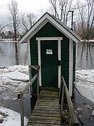
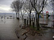
Many USGS gages like this one on the Great Chazy River may be closed in March due to a loss of federal funding. On November 29, Staff Scientist Mike Winslow was asked to discuss regulation of Lake Champlain’s level with the New York Citizens’ Advisory Committee (NYCAC). MORE Read...
News from Selected Category
The second round of important public meetings on the re-writing of the Lake Champlain Phosphorous Total Maximum Daily Load – or TMDL - the phosphorus reduction budget will be held November 14 – 17 in the southern portion of the Lake Champlain Basin. MORE Read...
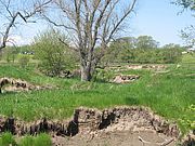
In 2011 LCC completed five years of monitoring at a stream restoration site in St. Albans. Rugg Brook was targeted for restoration following an LCC assessment of the watershed. Prior to restoration, the stream had cut up to 11 feet deep into a pasture; the banks of the stream were slumping and eroding, delivering tons of sediment to St. Albans Bay. MORE Read...
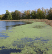
LCC completed its ninth season of blue-green algae monitoring on Lake Champlain. In 2011, volunteers collected 172 samples and there were 29 low alerts and two high alerts issued during the ten weeks of citizen monitoring. MORE Read...
(Adapted from an AP report)
A science program at the University of Vermont has been awarded a $20 million federal grant, the largest grant in the school's history, to help study the health of the Lake Champlain basin and look at the effects of climate change on it, officials announced recently. MORE Read...
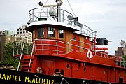
Commercial divers recently reached the shipwrecked tugboat McAllister to assess whether it still contained diesel fuel from when it sank in 1963. The wreck sits in about 165-feet of water off Schuyler Reef. The tug was carrying diesel fuel when it sank and had a capacity to hold up to 14,000 gallons of fuel. MORE Read...
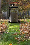
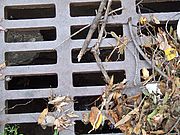
Piles of autumn leaves left in the road can become part of the stormwater problem for the lake. Help keep our waters clean by sweeping or raking leaves away from roadways. Mulch them with a few passes of the lawnmower so the nutrients left in the leaves go back to your lawn instead of into the lake. Read...
Installing a WaterSense labeled aerator to your faucet is one of the most cost-effective ways to save water. Also consider replacing the entire faucet with a WaterSense labeled model. Either way, you can increase a faucet's efficiency by 30 percent without sacrificing performance. MORE Read...
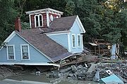
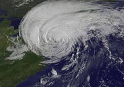
Under any scenario events like Tropical Storm Irene and the spring floods of 2011 will be extreme outliers; however, climate models do predict we should expect and prepare for more intense storms in the years to come. MORE Read...
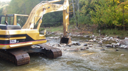
Tropical Storm Irene will shape our thoughts about and relationship with rivers for at least a generation. A previous generation reacted to the floods of 1927 by straightening and berming rivers and dredging sediments. Bulldozers ran down the rivers shoving stones aside. MORE Read...
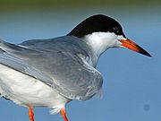
The sandbar at the mouth of Mill Creek in Port Henry is covered with loafing birds, white balls of feathers in various states of repose. Most are ring-billed gulls with a few other gulls mixed in, but two birds in particular stand out. They are the same size as the gulls with similar white plumage, but they have bright orange bills and a swept-back black crest like they just came from the salon. These are Caspian terns, one of three species of terns that can be found on Lake Champlain. MORE Read...
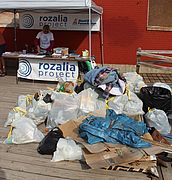
Thanks to the lake lovers who joined the Rozalia Project, LCC and other lake partners in a September cleanup of the Burlington waterfront! The afternoon effort removed 1,500 items and 408 pounds of debris along a half mile of shoreline. MORE Read...
This week, the Environmental Protection Agency and the Vermont Department of Environmental Conservation will host important meetings on the re-writing of the Lake Champlain Phosphorous Total Maximum Daily Load or TMDL - the phosphorus reduction budget. The meetings will focus on the northern portion of the Lake Champlain Basin. A second set of meetings are planned for November 14-18 for the southern portion. MORE... Read...
Join the Rozalia Project, LCC and other lake friends in a lakeside cleanup as part of the International Coastal Cleanup (ICC). The ICC is the world's largest effort for ocean (and lake) health with millions of volunteers from over 150 countries cleaning their lakes, rivers, bays and oceans. Registration begins at Burlington’s Community Sailing Center (CSC) at 12:30 PM Saturday, September 17, followed by a waterfront cleanup from 1:00 PM-3:00 PM, capped off by a Trash Bash from 3:00 PM–4:00 PM featuring food and give-aways. Hand in your trash and data cards, try your luck at some great prizes, and check out the slide show presentation by Rachael Miller of Rozalia Project documenting their summer adventures picking up marine debris, freeing entangled creatures and working for clean water...MORE Read...
Please join Lake Champlain Committee board, staff and friends at "The Big House" at Sunnywood in Chazy, New York on Saturday, October 1st from 2:00 PM-5:00 PM for our 48th Annual Meeting. Learn about LCC’s work and lake issues, get a guided tour of the Sunnywood family compound, and enjoy a light fare of savory and sweet treats from area purveyors. Bill Howland, Manager of the Lake Champlain Basin Program, will give the guest address on the “Great Floods of 2011”. He will present a dramatic slide show covering historic spring flooding, Tropical Storm Irene and how we can protect our waterways in the future followed by a question and discussion period. Directions and further details will follow in a subsequent email...MORE Read...
Between 7:00 AM and 4:00 PM on Sunday August 28th Lake Champlain rose approximately three feet according to the gauge in Whitehall, NY at the southern end of the lake. Over the same time span the gauge at Rouses Point at the northern end of the lake suggested lake level had dropped by over a foot. The winds of Tropical Storm Irene, with sustained winds over 35 knots (40 mph) and gusts up to 45 knots (52 mph), had pushed the surface water of the lake south where it piled up in Whitehall...MORE Read...
Tropical Storm Irene delivered another slug of nutrients and sediments to Lake Champlain along with tremendous quantities of debris causing challenges for navigation. Boaters should use extreme caution on the water. Conditions are particularly treacherous at night. Read...
Lake Champlain was above flood stage for two months this spring. The record flooding that occurred in New York, Vermont and Quebec has led to calls for the governments to ‘do something’. Vermont Governor Peter Shumlin and Quebec Premier Jean Charest have asked President Barack Obama and Canadian Prime Minister Stephen Harper to charge the International Joint Commission (IJC) with researching ways to reduce flooding near Lake Champlain and the Richelieu River. The IJC is responsible for overseeing international boundary waters...MORE Read...
On Friday August 26th the 402 foot center span for the new Champlain Bridge was floated from Port Henry to Crown Point, lifted into place, and secured to the east and west bridge approaches. Now bridge construction enters its home stretch. Outstanding work includes adding the deck of the center span, attaching pedestrian sidewalks outside the arch, and completing various finishing touches. The $69.9 million bridge is expected to be completed before the end of the year according to John Grady, construction engineer for the New York State Department of Transportation. Until the bridge is completed the ferry that provides 24-hour service between Vermont and New York will continue to operate. Click here for visual updates of the bridge construction. Read...
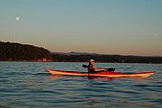
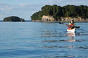
Late summer and early fall are wonderful times to be out on the water. Be sure you have the 2011 edition of the Paddlers’ Trail guidebook in tow. It’s filled with important information for great adventures on the water including site descriptions and chartlets for 39 Trail locations (with access to over 600 campsites), launch site listings, natural history articles, safety and stewardship tips, equipment check lists and more! - And it's available to all members who renew annually for $45 or more. Click here to make an online donation to ensure you have the guidebook in hand for the rest of this paddling season. Happy, safe adventures on the water! Read...
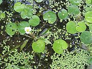
A new population of European frog-bit was discovered during a plant survey in Missisquoi Bay. Researchers from LCC and Arrowwood Environmental had been surveying the plant communities (video) when they came across the population in an isolated embayment near the mouth of Dead Creek on the eastern side of Missisquoi Bay. “It’s a small population with a few scattered individual plants which we removed,” reported LCC Staff Scientist Mike Winslow.
The plant survey is funded by a grant to LCC from the Lake Champlain Basin Program. LCC’s aquatic mapping and removal project is proactive, seeking and eradicating invasive plant populations before they become established. Once a species becomes established, eradication is infeasible in most situations. Our work can prevent species from expanding in the lake. By the end of August, more than half of the Missisquoi Bay plant community had been sampled. Work is expected to continue through September. Read...
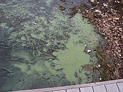
The 2011 blue-green algae monitoring season is winding down. This year following spring flooding, blooms in Missisquoi Bay were extensive and thick. Additional persistent blooms were found in St. Albans Bay and sporadic blooms occurred throughout other portions of the lake. For information about the latest status of algae blooms on Lake Champlain visit LCC’s website or the Vermont Department of Health’s blue green algae page.
Each summer since 2004 LCC has partnered with the University of Vermont Rubenstein Lab, to expand blue green algae monitoring on Lake Champlain. LCC helps train and oversee citizen monitors who take weekly water samples from select shoreline areas. We also monitor several shoreline beaches, do visual site checks at additional locations, and serve as a first responder when blooms are underway. This award-winning program, which LCC initiated, provides critical data on where and when blooms are happening. The information we gather is used by public health officials to assess whether the water is safe for swimming. Our dedicated group of volunteer monitors go out once per week from early July through Labor Day to collect samples and take them to designated drop-off locations. Read...
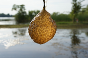
Brown jelly-like blobs have been reported from various places around Lake Champlain this summer. The patterning on the surface of the blobs makes them resemble brains or diseased tree branches. These are actually colonies of sessile invertebrate animals called bryozoans. While the blobs may range from golf ball to melon-sized, each individual in the colony is microscopic. Most bryozoan species live in marine environments, but 50 species are known from freshwater including 21 from North America. The species most commonly observed in Lake Champlain is probably Pectinatella magnifica. Bryozoans tend to grow on wood or other vegetation in areas where the water is quiet. They do not tolerate polluted conditions and require fairly high oxygen levels in the water. Occasional summer outbreaks have been recorded on other waterbodies, but it is unclear why they happen. Read...
One small step you can take to minimize damage from storms to local roads and waterways including Lake Champlain is to clear any storm drains in your neighborhood. When storm drains clog, the water that they are designed to collect bypasses the drains and erodes at road beds. In addition to weakening the road the eroded soils wash into water bodies adding to the pollution load from storms. Unclog the drains by simply removing any debris on the grate or blocking water’s access to the grate. It’s a small step, but every little bit helps. Read...
If you’ve had an address change recently, please send us an email so we can update your files and ensure you receive news on lake issues and LCC’s work. Our primary form of communication with members is through email. By mailing electronically we save time and resources and reinforce the stewardship ethic of our mission. We don’t give away or sell email addresses. To ensure that our email messages get through to your inbox, please add lcc@lakechamplaincommittee.org and the domain enews.lakechamplaincommittee.org to your safe/allowed list and address book. Thanks! Read...
The owners of a tugboat that sank on Lake Champlain in 1963, the week before President Kennedy’s assassination, has agreed to begin efforts to remove any residual fuel left on the boat. The tug, an oil tanker, struck Schuyler Reef and sank in waters over 100’ deep. According to an AP report, McAllister Towing and Transportation Co. is negotiating with a Buffalo company to send a diver to the wreck to see if any fuel remains aboard. The expedition had originally been planned for late May, but high lake levels forced a delay. Read...
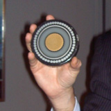
Transmission Developers, Inc. (TDI), a Canadian Company, is continuing to push for an electric power line to be placed on the bottom of Lake Champlain and the Hudson River.
The line would provide energy for the New York City area. TDI has made some changes in their preliminary design so that they would now avoid wetlands in the narrow southern part of Lake Champlain routing the line overland in that stretch. LCC had raised this concern in meetings regarding the project. TDI is currently making its case before the New York Public Service Commission and a joint proposal is anticipated by August 12th. In a recent press release the company touted support from 20 members of the New York State Congressional Delegation including Representative Bill Owens of Plattsburgh. Read...
The 2011 edition of the Lake Champlain Paddlers' Trail Guidebook and Stewardship Manual is out! It’s jam-packed with important information for great adventures on the water including site descriptions and chartlets for 39 Trail locations (with access to over 600 campsites), launch site listings, natural history articles, safety and stewardship tips, equipment check lists and more! - And it's available to all members who renew annually for $40 or more. Click here to make an online donation to ensure you have the guidebook in hand for the rest of this paddling season. Sincere thanks to all the federal, state, and municipal staff and the many volunteers who worked tirelessly to clean up recreation areas and Trail sites and ready them for the season. In June many Trail locations were still under water or affected by the flooding. Without the tremendous effort of many people, we would not have been able to open as many Trail sites this year. Our sincere thanks to all who participated in the clean up. Here’s to happy, safe adventures on the water! Read...
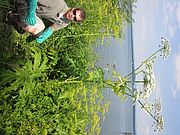
An astute resident found a new population of an invasive species near the ferry dock in Essex, NY. The plant, giant hogweed, is a federally listed noxious weed within the carrot family. Exposure to its sap can cause severe skin irritation, blistering, scarring and even blindness. The plant can grow up to 12 feet in height. Dr. Alan V. Tasker, of the U.S. Department of Agriculture’s National Noxious Weed Program, says people can distinguish giant hogweed from other species of the carrot family, not only by its gargantuan size, but by its purple-splotched, hairy stems. “Cow parsnip stems have a more ‘furry’ look to them, whereas the hogweed has long, white hairs which are most pronounced at the base of the leaf petiole (stem). But the foliage of cow parsnips and giant hogweeds before they send up flower stalks is so similar it’s almost impossible to tell them apart.”
Giant hogweed is a native of the Caucasus Mountain region between the Black and Caspian Seas. It was introduced to Europe and the United Kingdom in the late nineteenth century and to the United States in the early twentieth century as an ornamental garden plant. It has become established in New York, Pennsylvania, Ohio, Maryland, Oregon, Washington, Michigan, Virginia, Vermont, New Hampshire and Maine. Seeds may also be distributed by birds and waterways, and can remain viable for over 10 years.
NY DEC working in collaboration with town officials and The Nature Conservancy began immediate efforts to eradicate the Essex population and prevent its spread. Read...
~ Step on it: Grass doesn’t always need water just because it’s hot out. Step on the lawn, and if the grass springs back, then it doesn’t need water. An inexpensive soil moisture sensor can also show the amount of moisture at the plant’s roots and discourage overwatering.
~ Time it right: It’s best to water lawns and landscapes in the early morning and late evening because significant amounts of water can be lost due to evaporation at other times of day.
~ Tune up your system: Inspect any irrigation systems you might have and check for leaks and broken or clogged sprinkler heads. Fix sprinkler heads that are broken or spraying on the street or driveway.
~ Give your hose a break: Sweep driveways, sidewalks, and steps rather than hosing them off. And don’t forget to check for leaks at your spigot connection and tighten as necessary.
~ Leave it long: Raise your lawn mower blade. Longer grass promotes deeper root growth, resulting in a more drought resistant lawn, reduced evaporation, and fewer weeds. Read...

